On the Map
Wet-plate collodion photographs in collaboration with Rodolfo Salgado Jr of River City Tintype
 |  |  |  |  |
|---|---|---|---|---|
 |  |  |  |  |
 |  |  |  |  |
 |  |  |  |
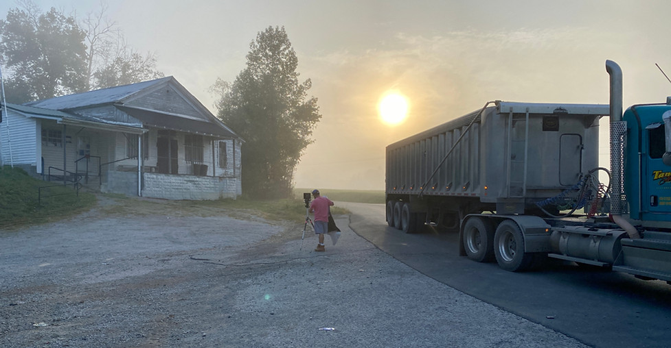
How does a town begin? For centuries, the naming of a US Post Office has inscribed the presence and identity of a place. From the 1860s to the 1930s, itinerant tintype photographers brought their mobile darkrooms to rural communities. Some summoned ghosts in the backgrounds of their images, while others documented soldiers and the deceased for family albums. Mail was heavy with tintypes–the first affordable means for Americans to share images with distant family and friends. Susanna Crum and Rodolfo Salgado Jr traveled with a mobile darkroom around the state of Kentucky, investigating historical post office sites with this 170-year-old method. In their hours spent producing hand-poured plates on site, they met property owners, postmasters, and community members, learning about the pasts and futures of these anchors of place. On the Map includes original tintype images, drawings, and postcards from this research-led journey.
This project was supported by the Indiana University Southeast Summer Faculty Fellowship and Grant-in-Aid.

Print media like stone lithography, relief printing, and intaglio have served as mechanisms to define and disseminate social norms and knowledge. Technical innovations in commercial and industrial contexts soon overlapped with fine art applications, and vice versa. When photographic printing methods were first developed in the 1840s, a flood of new printing techniques entered the market, and wet plate collodion photography (“tintype”) became widely accessible and affordable social media for consumers. William Mumler captured spirits in tintype portraits, reuniting bereaved Americans with their deceased relatives, and the photo album became a popular fixture in American homes. Traveling tintype photographers frequented even the most rural towns, often trailing Union Army troops with tents, portable buildings, and photographic studio cars.
In 1862, the United States Post Office was flooded with letters and postcards containing tintypes–the first photographic images to be placed in the mail–and the first topographical maps of post offices were produced and sold to the public. As David M. Henkin describes in The Postal Age, the decades preceding the Civil War were a time of “extraordinary mobility” in the United States, reinforced by a swiftly-expanding system of postal routes, mass distribution of newspapers, and federal support of a free press through reduced postage. Unlike cumbersome, expensive, and fragile techniques like daguerreotype, “cheap and omnipresent pictures” in the form of tintypes were were small and printed on lightweight but sturdy metal plates–the first to be safely mailed in envelopes. Together, the tintype and post office network constituted an inexpensive and accessible social media platform.
Post offices have long been markers of “the beginning of history” of a place. In rural communities like Appalachian coal towns, record-keeping—and even place-naming—did not take place until a post office arrived. A post office put a community “on the map.” In 2020, post offices continue their important roles as hubs for information exchange and markers of local identities. However, recent closures may signal a community in decline. Since 2007, more post offices have closed in Kentucky than any other state. Most of the Kentucky towns that have lost a post office are rural, unincorporated, and losing people. Disproportionately poor and elderly, they’re places where vital services are already difficult to access and where high-paying jobs can be hard to find. Even in a digital world, delays in shipments of medicines, payments, and correspondence put Americans at risk.
What did post offices look like, and where were they, at a time when letters and tintype photographs were among the first widespread and accessible social media?
